(Originally published in 2012)
New York Harbor to the Chesapeake
After anchoring inside the hook at Sandy Hook where we reminisced over our trip down from the Great Lakes to New York Harbor, we left the protection of Sandy Hook only to find ourselves motoring through a fogbank. This sensation was new to us and without the benefit of radar we felt really uncomfortable and vulnerable. Frankly it was downright spooky. We were motoring along the coastline a mile or so offshore, listening carefully for other boats (as carefully as you can listen when you’re literally standing on top of a roaring diesel engine), passing the occasional fisherman in a small boat fishing, but unable to see much beyond the bow of our boat. Occasionally the sea fog would break into shreds and tatters of wispy cloud and we would get a glimpse of our surroundings, and then it would close back into a dense shroud and we were once again alone in our own little world.
The Jersey shore is one, huge, 200 mile long beach. In a boat with a reasonably shallow draft there are an incredible number of inlets where you can tuck in and anchor, but the constant shifting of the sandy bottom contours makes charts pretty unreliable and you need the benefit of some local knowledge, or at least a good depth sounder and a shoal draft vessel. The Coast Guard warns about charts and markers being quite unreliable in most areas of the Jersey coast due to this constant bottom shifting. Therefore, especially for us with our 7-foot keel, we were better off sticking with the well-established, more dependable ports.
Eventually we ended our day when we arrived at Manasquan Inlet where we fueled up and made an overnight stop at the Shrimpbox Restaurant. A stop at the Shrimpbox was designated a “must” as far back on our trip as Little Falls, NY on the Erie Canal where another cruiser had recommended it. At that time, if a cruising boat spent twenty dollars on dinner there, one was allowed to tie up alongside their dock overnight for free. We decided to take a break from living in economy mode and test the local seafood fare. With our dinner and wine we easily met the minimum and enjoyed a great meal. Prior to visiting the Shrimpbox we had gone further up into the inlet and found very cheap diesel fuel at a local Texaco station. However, on our way back toward the restaurant we ran aground for a half hour or so in the middle of the inlet channel (further testament to our “if it’s worth seeing, we’ve been aground there…” tails) before the tide lifted us off. After dinner we took a pleasant walk and headed down to the beach and the local boardwalk. Manasquan’s typical Jersey boardwalk with all its shops and entertainment evoked memories of lyrics from early Bruce Springsteen songs that I remembered from 25 years earlier – back when he and the E Street Band were still struggling for commercial success – songs that most fans of the Boss have never even heard. Manasquan is only a few miles from Asbury Park where Springsteen grew up and wrote those songs. Now, after a nasty hit by Hurricane Sandy and then other storms over the past few years, much of this coastline has been changed forever. I know the Shrimpbox has returned, but how many other things along the Jersey coast will be reincarnated I couldn’t tell you.
From Manasquan, we continued south to Absecon Inlet and Atlantic City where we stopped at local commercial marina. The currents in Absecon Inlet can be treacherous when the tide is running. We made use of the local bus system to briefly visit a few of the local casinos and “pay” our respects, and next day we were off to Cape May, our final stop on the Atlantic coast.
At this time, since we were ultimately headed for Baltimore on this trip, it was time to decide whether we wanted to continue down the Atlantic coast, along the Delaware coast and around the DelMarVa Peninsula into Chesapeake Bay, or take the much quicker, much less exposed shortcut around Cape May and up Delaware Bay to the Chesapeake and Delaware Canal. The C & D Canal cuts through a narrow neck of land in northern Maryland and connects the western shoreline of Delaware Bay (which extends northward toward Philadelphia as the Delaware River. We all have seen that famous painting of George Washington Crossing the Delaware where he is standing in the bow of the boat, maybe trying to throw a silver dollar across…. Again, I digress.) with the northern reaches of Chesapeake Bay.
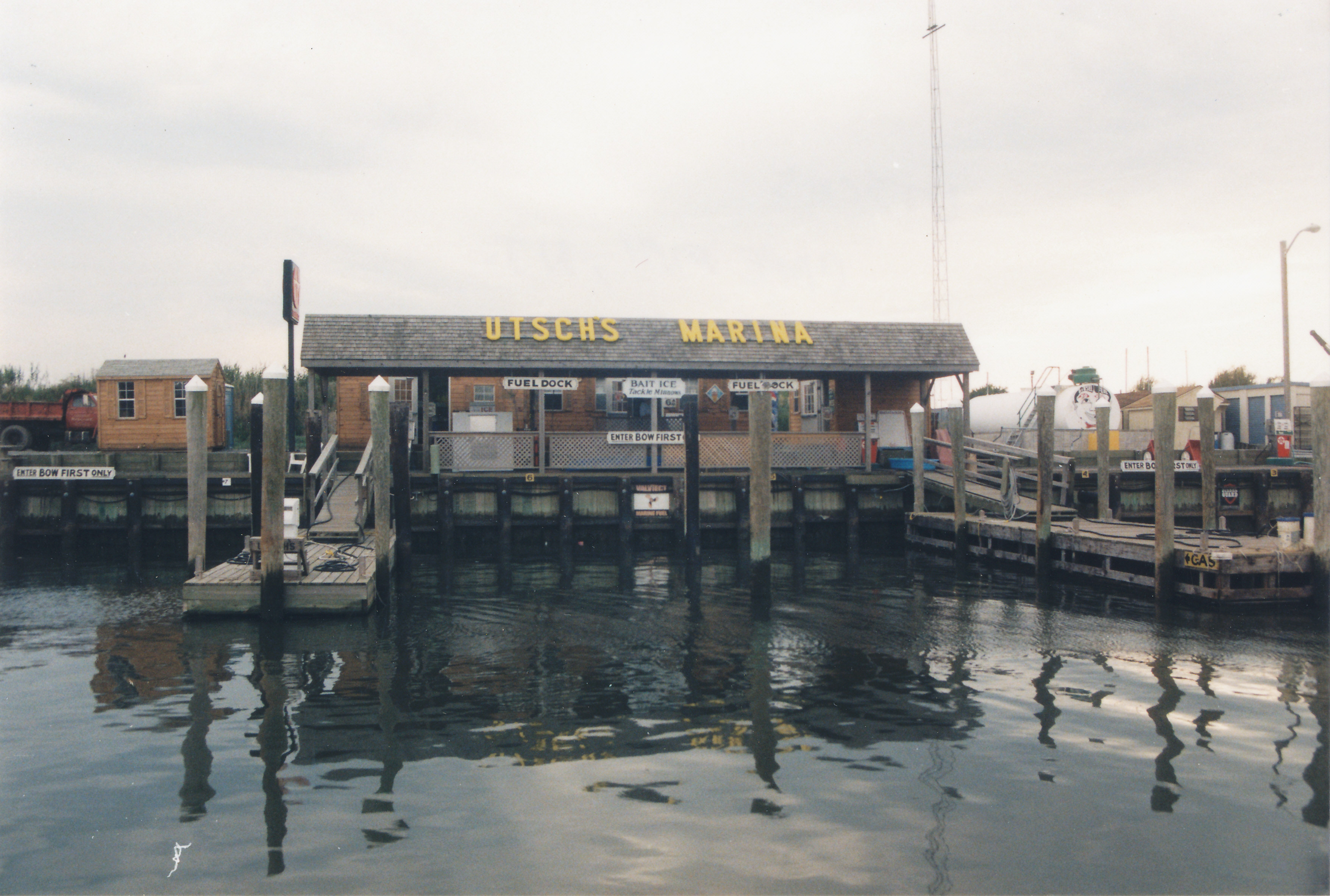
We entered the harbor at Cape May, headed for Utsch’s Marina and a slip for the night. While heading through the harbor we ran aground once again. Even though our evaluation of all of the surrounding daymarks told me we were in the middle of the channel, we were hard aground. Here we were, only a couple hundred yards from the entrance to our marina destination, stuck again. Fortunately it happened on the rising tide and we just relaxed and ate lunch while we waited an hour or so for the tide to lift us off. While we were waiting, we radioed Utsch’s Marina for directions for entering and got explicit directions: “Turn hard to port at #14 daymark and stay forty feet off the wall until you get to the entrance.” Once we broke loose from our embrace with the bottom, we followed their advice to the letter and made it into the marina only to run aground one more time right in the middle of the marina. We radioed in, explaining our predicament and our 6 ½ foot draft, and they sent one of their boats over to tow us to our proper place, which, given our circumstances and lack of maneuverability, turned out to be a parking spot on the T-head of one of their piers. Ah, home at last! In our defense, we were arriving on one of the most extreme tides of the year, solar or lunar eclipse or some such nonsense (celestial events usually have dramatic effects on tidal movement), so, ourselves included, nobody found our grounding situation to be particularly surprising or embarrassing. For us it was a record two groundings in a matter of a couple of hours. Utsch’s Marina is located right beside the entrance to the Cape May Canal, so offered a convenient departure point for doing the canal.
Once we were tied up here I walked across the adjacent ICW bridge to the nearby Texaco station where I filled an empty LP gas tank, then visited the neighboring West Marine store, most likely for some trumped up reason. I can’t pass a marine store without going in and finding something that I can’t do without – sound familiar?

It was in Cape May where, during an extra weather day, we finally met up with our eventual friends, Carol and Dick, aboard their 35 foot Endeavor, Buckshot. We had first seen their boat way back in Lorain, Ohio while we were crossing Lake Erie. They weren’t around at the time, but the boat caught our attention because it was the first boat we had encountered that was all fitted out for transiting the Erie Canal, with its well-constructed mast supports on deck and everything ready to go. Then we played leapfrog with them during our passage of the canal but only spoke briefly in passing with comments back and forth between our boats as we tended to the business of doing the canal. Finally in Cape May, here they were at Utsch’s tied up near us, and we got together for a little walking tour around town and some lunch. They turned out to be longtime friends even after we both quit cruising.
Next morning we were off. The Cape May Canal is a simple shortcut across the bottom of the New Jersey peninsula, connecting the Atlantic Coast with the protected waters of Delaware Bay. It is a simple ditch without any locks but it cuts off a significant 20 miles or so of travel down and around the tip of the peninsula. We were aware of the two ICW type highway bridges that cross the canal with a stated clearance of 55 feet. “Local knowledge” put them at more like 52 feet so we, with our 50-foot mast, were a little nervous about passing beneath them. We left the marina a couple of hours prior to high tide and headed off into the canal. As we were motoring slowly along in our approach to the first bridge, I was so absolutely certain that we were going to hit the bridge with our mast that I throttled back and shifted the transmission into neutral and then reverse in an effort to avoid the inevitable collision. Not surprisingly, during the seconds that followed, the current in the canal combined with our momentum to carry us unavoidably toward disaster and we amazingly passed under both bridges with room to spare and exited the canal into an absolutely flat calm Delaware Bay. So much for optical illusions. We had departed Utsch’s Marina at 0700 and popped out into Delaware Bay at 0730 – a lot of excitement packed into a pretty short window. Or much ado about nothing…

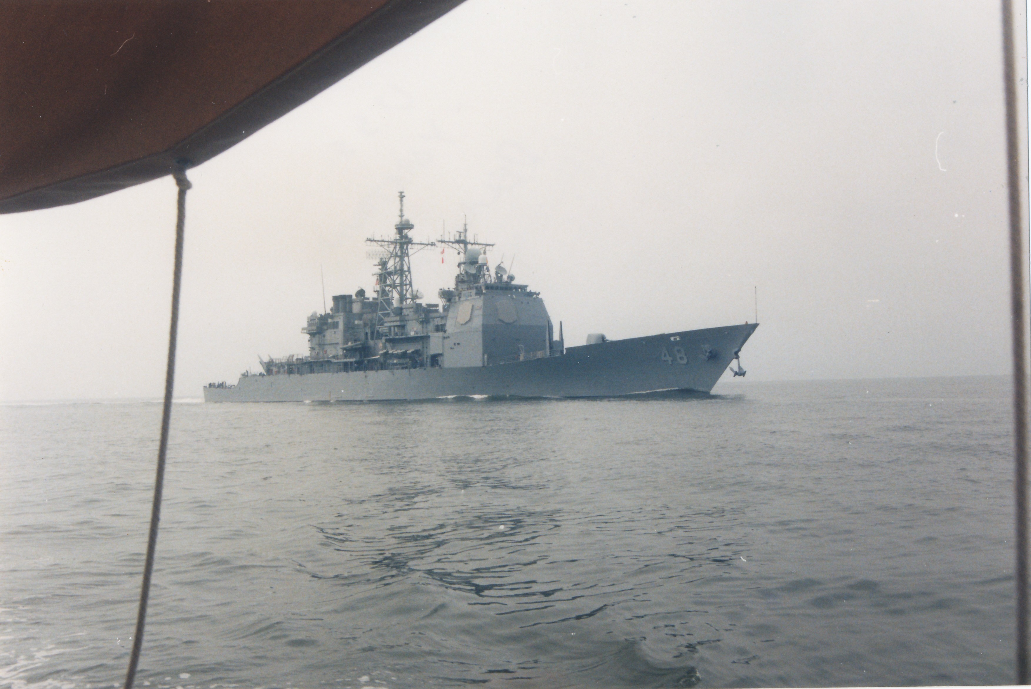
As we motored further up into the bay we were comfortable that we had made the right decision in taking this route. When I was originally planning this trip I was afraid that, with our draft and the limited options for refuge along the course, we would be quite vulnerable to any bad weather that might kick up on Delaware Bay. Therefore, we originally had planned to bypass Delaware Bay. We were going to simply cruise down the coast of the DelMarVa Peninsula and enter the Chesapeake at its mouth. Once we arrived in Cape May, the Delaware Bay route looked much more appealing. Beautiful, clear, hot, high-pressure-dominated weather continued day after day, and the additional distance required of the coastal route (about 500 extra miles to go down around the peninsula and back up to the Baltimore/Annapolis area) ultimately made the decision for us. In retrospect the trip up Delaware Bay was smoother than any of our Saginaw Bay trips up on Lake Huron ever were. The air was so still that we motored the entire distance in a flat calm. About half way to the C & D canal entrance, we were surprised and amazed when the U.S. Navy cruiser U.S.S. Yorktown almost ran us down from behind. These ships are so fast. One second there is nothing visible astern and the next thing you know the radio is warning you that you are in danger and need to give way! We moved over and let them by. Otherwise the trip was uneventful and we arrived at the entrance to the Chesapeake and Delaware Canal in the early afternoon.
At the entrance to the C & D Canal, we stopped at Shaffer’s Restaurant and Marina. We found the seafood buffet there to be a disappointment. It was okay but overpriced for what it was. Because of the tidal differential between Delaware Bay and the adjoining Chesapeake Bay, the currents do some rather radical things in the C & D. My impression is that slack tide is probably the best time to come and go. We had tried to get into an adjacent service basin near the restaurant in hopes of anchoring for the night, but another grounding incident put the kibosh on that plan.
Coming out of the C & D Canal toward the Chesapeake you are dumped into the Elk River. All of a sudden it’s time for “Life on the Chesapeake” – unlike anywhere else that I have cruised. The shorelines of the entire bay and its adjoining creeks and rivers are like an obstacle course for cruising vessels. It’s time to start watching for clam lines and the ubiquitous crabpot markers. Anytime water depths are in the 10 to 25 foot range on the Chesapeake and its many tributaries, floats of some sort are likely to be an issue. Every arm, neck, or other point of land, as well as presenting a favorable anchorage also offers an attractive location for crabpots. Give them a liberal berth. The lines are longer than the water is deep and can easily get caught and wrapped around the propeller shaft of the careless boater. We headed down to the Sassafras River and anchored. A seeming record number of crab pot markers greeted us at both points of the river entrance.
If you have never sailed on Chesapeake Bay, the opportunities for anchoring are limitless. The holding in the legendary Chesapeake Bay mud is usually solid and achieved with very little effort. Creeks, rivers, and coves are seemingly present every few hundred yards. From wherever you happen to drop the hook, you can often see another four or five attractive spots you might like to try next time around! It’s a veritable gunkholer’s paradise.
Next day, from the Sassafras River we headed down to our destination on the Chester River. This final anchorage presented us with a fitting finale to our passage from the Great Lakes to the Chesapeake. We were anxiously watching the sky for the last few miles of the trip as we approached a point in the Chester River which we hoped would provide us some protection from a rapidly approaching squall line coming at us from the west. As we rounded the point of land on Eastern Neck Island and motored in behind it for protection from the west wind, I ran forward as Annie took the helm. When we had what we hoped was sufficient protection I dropped the anchor in twelve feet of water and we let the wind set it for us as I rushed back to the cockpit. Annie suggested that perhaps we should take down the awning before the windwall hit us. I didn’t think we had time to take it down and commented that it would probably do fine – it always had. As the wall of wind hit us there was a loud r-r-r-rip! and we reached up to grab the edge of the awning where it was attached to the boom gallows. Too late, as it tore completely through for the entire width and we were standing there desperately clinging to the edge, holding it above our heads as the wind whipped and the rain began blowing down sideways in sheets. Looking at each other with rain streaming down our upstretched arms, hair plastered to our heads, we both burst out laughing and simultaneously yelled above the whistle of the wind “Here we are living the dream!” Fortunately the squall passed as quickly as it arrived and we only had minor cleanup duty down below from the incursion of the rain through the companionway hatch. The wind had blown a good 50 mph when it hit us, and earlier the storm had done some significant damage across the bay in Annapolis as it passed through, knocking out power to a large number of homes.
We had finally arrived. Our destination at Lankford Bay Marina was just a mile or two upriver. We picked up our anchor and headed over to the marina. The long sojourn from the Great Lakes to the Chesapeake Bay was at an end. It wasn’t the end of our time aboard though. We still had a few weeks left to enjoy the sailing and the anchoring and the ambiance of life aboard on the Chesapeake.

Leave a Reply